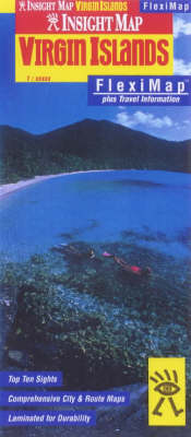
Virgin Islands Insight Fleximap
Synopsis
Part of the Insight Flexi Map range, this map of Virgin Islands gives you everything need from a durable, ultra portable, folded sheet map. This flexi map of US and British Virgin Islands contains 11 maps, including British Virgin Islands, US Virgin Islands, Charlotte Amalie, Cruz Bay, St Croix, Christiansted, Frederiksted, Road Town, Anegadad, Spanish Town and a locator map of the islands. It also lists Top Ten recommended sights - from the romantic Deadman's Bay Beach to the tropical Sage Mountain National Park Containing detailed and clear, digital cartography, this Virgin Islands Flexi Map also features: a comprehensive index, recommendations for up to 30 sights all cross-referenced to the map and other relevant tourist information. Its laminated finish ensures this map is waterproof, hard-wearing and durable, scribble friendly and tear resistant. This informative and easy-to-use map is also easy to fold, even in windy conditions, so it can go wherever you go! The Virgin Islands Insight Flexi Map has a scale of 1:90Th.
Publisher information
- Publisher: APA Publications
- ISBN: 9789812343932
- Weight: 68g
Customer Reviews
You may also like...