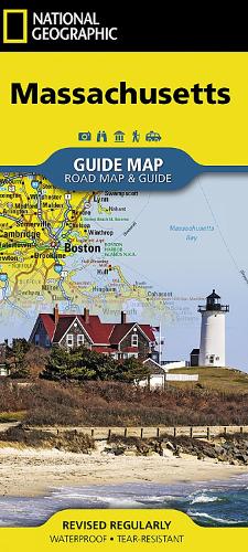
Massachusetts Map: Guide Maps
Synopsis
• Waterproof • Tear-Resistant • Travel MapCombining a comprehensive road map with a convenient travel guide, National Geographic's Massachusetts Guide Map is an essential travel companion for all visitors. The main map's road network is complemented by a user friendly index of counties, cities and towns. Clear designations are given for free access and toll roads; interstate, state and country routes; paved and unpaved roads; and scenic byways. Major highways are shown with mileage markers and roadside rest areas. Points of interest, national and state public recreation areas, airports, hospitals, ski areas and visitor centers are all pinpointed.Detailed inset maps show the Boston metropolitan area, downtown Boston, Lowell, and Worcester. A travel guide to Cape Cod National Seashore, complete with map and contact information, is also provided along with a chart showing the available services in the state's abundant national parks and sites. A calendar of events and points of interest guide describe and provide contact information for many of the most popular attractions. Every State Guide Map is printed on durable synthetic paper, making them waterproof, tear-resistant and tough — capable of withstanding the rigors of any kind of travel.
Publisher information
- Publisher: National Geographic Maps
- ISBN: 9781566957786
- Number of pages: 1
- Dimensions: 2200 x 1000 mm
- Weight: 80g
- Languages: English
Customer Reviews
You may also like...