Synopsis
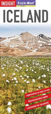
Flexi Map Iceland is a laminated, tear-resistant map which has 3 separate maps, each one accompanied by its own index. It includes a list - with descriptions and some photographs - of 29 recommended sights, divided by theme and linked to the mapping by numbered markers. There is also a handy information section with concise details on getting around, tourist offices, money, tipping, opening times, public holidays, telecommunications, emergency telephone numbers and climate. The main map depicts Iceland at a scale of 1:910 000. All roads from main routes to tracks with loose surfaces are shown; intermediate distance indicators on even minor routes are given. Places of interest, including national parks, skiing and rambling areas are clearly identified using easy to recognise pictorial symbols. The country's terrain is shown by the use of relief shading with some peak heights given. Reykjavik is shown at a scale of 1:12 000, streets, public buildings, hotels and places of interest are clearly highlighted and named. Reykjavik's environs are depicted at 1:350 000 and clearly shows all major routes into the capital.
The index for this map lists places of interest, public buildings as well as individual farms and settlements.
Publisher information
- Publisher: APA Publications
- ISBN: 9781780056425
- Dimensions: 218 x 103 x 9 mm
- Weight: 56g
Customer Reviews
You may also like...