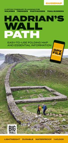
Hadrian's Wall Path: Easy-to-use folding map and essential information, with custom itinerary planning for walkers, trekkers, fastpackers and trail runners
Synopsis
The 138-kilometre Hadrian’s Wall Path traces a grey line along Great Whin Sill, the dolerite ridge chosen by the Romans for their historic wall. The route, one of Britain’s most popular National Trails, is dotted with milecastles and forts, and attracts trail runners and walkers all year round due to its sweeping views. Beginning in Newcastle, the trail passes through rolling grassy paths and grey-green crags to reach Bowness-on-Solway on the Cumbrian Coast. Hadrian’s Wall Path appeals to people who have different levels of experience and travel at all speeds, and this Vertebrate Publishing Guidemap is unique in that it caters for four categories of user, providing custom itineraries for walkers, trekkers, fastpackers and trail runners.
This lightweight, waterproof, durable and easy-to-use folding map features all the essential information for a successful Hadrian’s Wall Path, including 1:40,000-scale mapping for the linear route starting in Wallsend and finishing in Bowness-on-Solway. It also includes a detailed elevation profile and route planner, safety advice, terrain information and an accommodation directory, and a link to a GPX file download.
Publisher information
- Publisher: Vertebrate Publishing Ltd
- ISBN: 9781839810312
- Number of pages: 48
- Dimensions: 242 x 116 x 5 mm
- Weight: 60g
- Languages: English

You may also like...