Collins World Wall Laminated Map
Map Published on: 04/03/2010
Price: £12.99
Synopsis
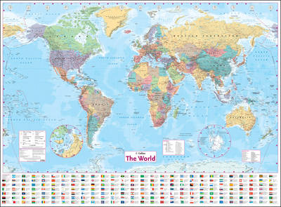
LARGE, FLAT LAMINATED (on front side only) EDITION (102 x 138 cm, 40 x 54 inches) A new, updated edition of this ideal reference map covering the whole world, showing the political units on each continent. Includes national flags and key statistics for every country. Scale 1:22 000 000; 1 cm to 220 km; 1 inch to 347 miles MAIN FEATURES Fully updated political map showing individual countries and includes roads, railways, cities and towns, and physical features. Inset maps of the polar regions, national flags and key statistics for each country. AREA OF COVERAGE All of the world, centred on the Greenwich Meridian. The map is printed on high quality paper and laminated - ideal for any classroom, bedroom or office wall.
Publisher information
- Publisher: HarperCollins Publishers
- ISBN: 9780007326884
- Dimensions: 1015 x 1380 mm
- Weight: 296g