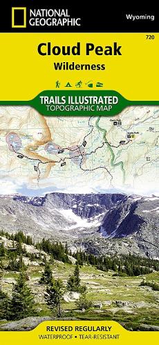
Cloud Peak Wilderness Map: Trails Illustrated Maps
Synopsis
• Waterproof • Tear-Resistant • Topographic MapWith nearly 200,000 acres, the Cloud Peak Wilderness in north-central Wyoming is the wildest section of the Bighorn Mountain Range. Expertly researched and created in partnership with the U.S. Forest Service and others, National Geographic's Trails Illustrated map of Cloud Peak Wilderness provides an unparalleled tool for exploring this rugged country and its fragile ecosystems. This map offers unmatched detail of the entire wilderness and parts of the surrounding Bighorn National Forest including such key areas of interest as Highland and Coffeen Parks, Meadowlark Lake, Upper and Low Paint Rock Lakes, Kearny Lake Reservoir, and Cloud Peak Skyway.Clearly maked trailheads will lead you to precisely mapped trails, marked according to their designated usage and displayed with mileage between trail intersections. Among the map's many features are contour lines and elevations, labeled peaks and passes, hundreds of water features and color-coded boundaries between private land, national forest and wilderness areas and no camp fire zones. High use zones, usually around certain lakes are highlighted as well. Camping guides list the areas campgrounds, with each one's elevation, facilities, size and usage. Other recreation features on the map include hiking registration boxes, fishing areas, alpine and cross-country ski areas, boat launch points and scenic viewpoints.Every Trails Illustrated map is printed on 'Backcountry Tough' waterproof, tear-resistant paper. A full UTM grid is printed on the map to aid with GPS navigation.Other features found on this map include: Bighorn Mountains, Bighorn National Forest, Black Tooth Mountain, Cloud Peak, Cloud Peak Wilderness.
Publisher information
- Publisher: National Geographic Maps
- ISBN: 9781566954174
- Number of pages: 1
- Dimensions: 2300 x 1100 mm
- Weight: 100g
- Languages: English
Customer Reviews
You may also like...