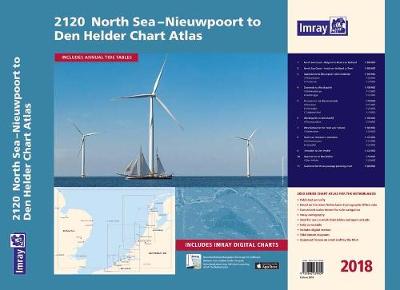
2120 Chart Atlas: North Sea - Nieuwpoort to Den Helder Nieuwpoort to Den Helder (including North Sea Passage Planning sheet)
Synopsis
Coverage is the North Sea coast, from the Belgian-French border, through the Zeeland, South Holland and North Holland coasts up to and including Den Helder.
Included in the atlas are all of the navigational charts and tidal data required for coastal passage and approach. Also included is a larger-format passage planning sheet for plotting routes across the North Sea.
Charts in the atlas include
1. North Sea Coast - Nieuwpoort to Hoek Van Holland (1:300 000)
2. North Sea Coast - Hoek van Holland to Texel (1:300 000)
3. Approaches to Nieuwpoort and Oostende (1:100 000) includes plans Niewpoort (1:30 000) and Oostende (1:20 000)
4. Oostende to Westkapelle (1:100 000) includes plans Blankenberge (1:15 000) and Zeebrugge (1:35 000)
5. Entrance to the Westerschelde (1:50 000) includes plans Breskens (1:15 000), Vlissingen (1:20 000) and Cadzand-Bad (1:10 000)
6. Westkapelle to Westhoofd (1:100 000) includes plan Roompotsluis (1:30 000)
7. West Schouwen to Hoek van Holland (1:100 000) includes plan Stellendam (1:30 000)
8. Hoek van Holland to IJmuiden (1:125 000) includes plans Scheveningen (1:15 000) and IJmuiden (1:35 000)
9. IJmuiden to Den Helder (1:125 000)
10. Approaches to Den Helder (1:50 000) includes plan Den Helder (1:20 000)
11. Southern North Sea passage planning chart (1:500 000)
Commended for the John C Bartholemew Award for Thematic Mapping at the 2016 British Cartographic Society Awards.
Publisher information
- Publisher: Imray, Laurie, Norie & Wilson Ltd
- ISBN: 9781846239809
- Number of pages: 11
- Dimensions: 420 x 590 mm
Customer Reviews
You may also like...