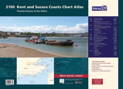
2100 Chart Atlas: Kent and Sussex Coasts
Synopsis
2100.1 Thames Estuary South
1: 120 000 WGS 84
2100.2 River Thames Sea Reach
1: 50 000 WGS 84
2100.3 The River Thames - Queen Elizabeth Bridge to Canvey Island
1: 35 000 WGS 84
Plans Coalhouse Point to Canvey Island, Queen Elizabeth II Bridge to Coalhouse Point
2100.4 The River Thames - Tower Bridge to Queen Elizabeth Bridge
1: 35 000 WGS 84
Plans Barking Creek to Queen Elizabeth II Bridge, Tower Bridge to Barking Creek
2100.5 River Medway
1: 40 000 WGS 84
Plans Gillingham Marina, Port Werburgh, Whitton Marine, Continuation of River Medway
2100.6 The Swale
1: 40 000 WGS 84
Plans Whitstable Harbour
2100.7 North Foreland to Dover & Calais
1: 115 000 WGS 84
2100.8 Dover to Dungeness & Cap Gris-Nez
1: 115 000 WGS 84
2100.9 Beachy Head to Dungeness
1: 115 000 WGS 84
Plans Sovereign Harbour, Rye Harbour
2100.10 Nab Tower to Beachy Head
1: 160 000 WGS 84
2100.11 Kent Plans - including plan of Calais
1: various WGS 84
Plans Ramsgate, River Stour Entrance, Dover, Calais, Folkestone
2100.12 Sussex Plans
1: various WGS 84
Plans Newhaven, Brighton Marina, Shoreham Harbour, Littlehampton, The Looe
Publisher information
- Publisher: Imray, Laurie, Norie & Wilson Ltd
- ISBN: 9781846239731
- Number of pages: 12
- Dimensions: 420 x 590 mm
Customer Reviews
You may also like...