
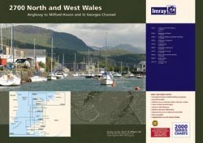
Imray Chart Pack 2700: North and West Wales
Map Published on: 17/12/2009
Price: £39.90
Synopsis
A pack of 10 charts covering the North and West coasts of Wales. In A2 format suitable for small chart tables and compatible with Yeoman plotters. The pack includes: 2700.1 Liverpool Bay and Anglesey 1:280,000 2700.2 Anglesey and Menai 1:145,000 2700.3 Southern Anglesey and Lleyn Peninsula 1:145,000 2700.4 Anglesey to Fishguard 1:280,000 2700.5 Cardigan Bay 1:145,000 2700.6 Aberaeron to St David's 1:155,000 2700.7 St George's Channel 1:280,000 2700.8 Menai Strait and The Swellies 1:70,000 2700.9 Cardigan Bay Plans (Fishguard, Aberdovey, Newport Bay, Mocras Lagoon, Aberaeron, Aberporth, New Quay, Aversoch, Pwllheli, Aberystwyth, Barmouth, Porthmadog) 2700.10 Tremadoc Bay 1:80,000
Publisher information
- Publisher: Imray,Laurie,Norie & Wilson Ltd
- ISBN: 9781846232596
- Number of pages: 10
- Dimensions: 596 x 840 x 5 mm
Customer Reviews
You may also like...


RYA Passage Planning
Price: £16.99

Yachting Monthly 200 Skipper's Tips
Price: £11.99
We, the Navigators
Price: £26.99
Marine Navigation 1 : Piloting
Price: £44.99

VHF Companion
Price: £10.78
Illustrated Sail & Rig Tuning
Price: £14.99

Knot Know-How
Price: £9.99
Coastal and Offshore Navigation
Price: £16.99
RYA Introduction to Radar
Price: £10.49
Skipper's Cockpit Guide
Price: £12.99

RYA An Introduction to Navigation
Price: £16.99
Cockpit Companion
Price: £10.78
Bernard's "Ideal" Bridge Order Book
Price: £13.20